
Anúncios
# HTML Article


Google Maps has revolutionized how we navigate the world, offering precise GPS tracking, real-time route planning, and accurate arrival times for every journey.
Anúncios
Whether you’re commuting to work, exploring a new city, or embarking on a road trip adventure, having reliable navigation tools at your fingertips transforms the travel experience. Gone are the days of unfolding paper maps or stopping at gas stations for directions.
Today’s digital navigation solutions provide comprehensive guidance that adapts to traffic conditions, suggests alternative routes, and keeps you informed about potential delays. Let’s explore how Google Maps GPS technology helps you trace your route, avoid unexpected surprises, and calculate exact travel times with remarkable precision.
Anúncios
🗺️ Understanding Google Maps GPS Technology
Google Maps leverages sophisticated GPS satellite technology combined with cellular data and Wi-Fi positioning to pinpoint your exact location. This multi-layered approach ensures accuracy even in challenging environments like urban canyons or areas with limited satellite visibility.
The system continuously triangulates your position using signals from multiple satellites orbiting Earth. When GPS signals are weak, the app seamlessly switches to cell tower triangulation or Wi-Fi network positioning, maintaining consistent tracking throughout your journey.
Real-time data processing analyzes millions of data points simultaneously, including current traffic patterns, historical travel times, road closures, and live reports from other users. This comprehensive approach creates a dynamic navigation experience that responds instantly to changing conditions.
📍 How to Trace Your Perfect Route
Setting up your route in Google Maps is remarkably straightforward, yet the app offers powerful customization options that many users overlook. Understanding these features helps you plan journeys that match your specific preferences and needs.
Starting Your Journey
Open Google Maps and tap the search bar at the top of your screen. Enter your destination address, business name, or point of interest. The app displays multiple results if your search isn’t specific, allowing you to select the exact location you need.
Once you’ve selected your destination, tap the “Directions” button. Google Maps automatically detects your current location as the starting point, but you can manually change this by tapping “Your location” and entering a different address.
The interface presents multiple route options, each with estimated travel times and distance information. These alternatives appear color-coded on the map, making visual comparison effortless.
Choosing Your Transportation Mode
Google Maps provides tailored routing based on your chosen transportation method. The app offers distinct navigation experiences for driving, public transit, walking, cycling, and ride-sharing services.
- Driving: Optimized for vehicles with real-time traffic updates and highway preferences
- Transit: Integrates bus, train, and subway schedules with walking connections
- Walking: Prioritizes pedestrian pathways and sidewalk routes
- Cycling: Highlights bike lanes and low-traffic streets suitable for cyclists
- Ride-sharing: Compares pricing and wait times across different services
Each mode considers specific factors relevant to that transportation type, ensuring recommendations that make practical sense for your chosen method of travel.
⚡ Avoiding Unexpected Roadblocks and Delays
One of Google Maps’ most valuable features is its ability to warn you about potential obstacles before they disrupt your journey. The app monitors your route continuously, alerting you to developing situations that might affect your arrival time.

Real-Time Traffic Monitoring
Google Maps displays traffic conditions using color-coded overlays on your route. Green indicates smooth flowing traffic, yellow suggests moderate congestion, orange warns of significant slowdowns, and red signals heavy traffic or standstill conditions.
This visual system allows you to quickly assess traffic patterns at a glance. The app automatically recalculates your route when detecting substantial delays, offering faster alternatives that save precious minutes.
Traffic data comes from multiple sources, including Android device location services, official transportation authorities, and user-submitted reports. This crowdsourced approach creates an incredibly accurate picture of current road conditions.
Incident Alerts and Road Closures
Beyond traffic congestion, Google Maps notifies you about accidents, construction zones, road closures, and other incidents affecting your path. These alerts appear as icons along your route with brief descriptions of the situation.
Users can contribute to this collective knowledge by reporting incidents they encounter. This community-driven approach ensures that information stays current and relevant, helping everyone navigate more effectively.
When significant obstacles appear on your planned route, the app proactively suggests detours that circumvent the problem area. You can accept these suggestions with a single tap or continue on your original path if you prefer.
⏱️ Calculating Exact Travel Time
Google Maps excels at predicting how long your journey will take with remarkable accuracy. The algorithm considers numerous variables that influence travel duration, creating estimates that typically align closely with actual arrival times.
Factors Influencing Time Estimates
The calculation engine analyzes current traffic conditions, average speeds on different road types, historical patterns for specific times and days, traffic signals, stop signs, and known speed limits throughout your route.
For longer journeys, the system incorporates predictive modeling that forecasts how traffic conditions might evolve during your trip. If you’re departing during rush hour but will reach certain areas after peak times, the estimate reflects those changing patterns.
Weather conditions, special events, and seasonal variations also factor into predictions. The app learns from millions of completed journeys, continuously refining its accuracy through machine learning algorithms.
Departure and Arrival Time Options
Google Maps offers flexibility for planning future trips. By tapping the menu icon and selecting “Set depart or arrive time,” you can view predictions for different departure windows.
This feature proves invaluable when scheduling appointments or catching flights. You can determine the optimal departure time that ensures punctual arrival while avoiding unnecessary early departures.
The interface displays how travel times vary throughout the day, helping you identify periods with lighter traffic that might significantly reduce your journey duration.
🚦 Advanced Navigation Features
Beyond basic routing, Google Maps includes sophisticated features that enhance the navigation experience. These tools provide additional context and convenience that transform how you interact with the app during travel.
Lane Guidance and Exit Information
When approaching complex intersections or highway exits, Google Maps displays lane-by-lane guidance showing which lanes lead to your destination. This visual assistance eliminates last-minute lane changes and reduces stress in unfamiliar areas.
Exit numbers, street names, and distance to turning points appear clearly on screen. Voice guidance announces upcoming maneuvers with sufficient advance notice, allowing you to position yourself appropriately in traffic.
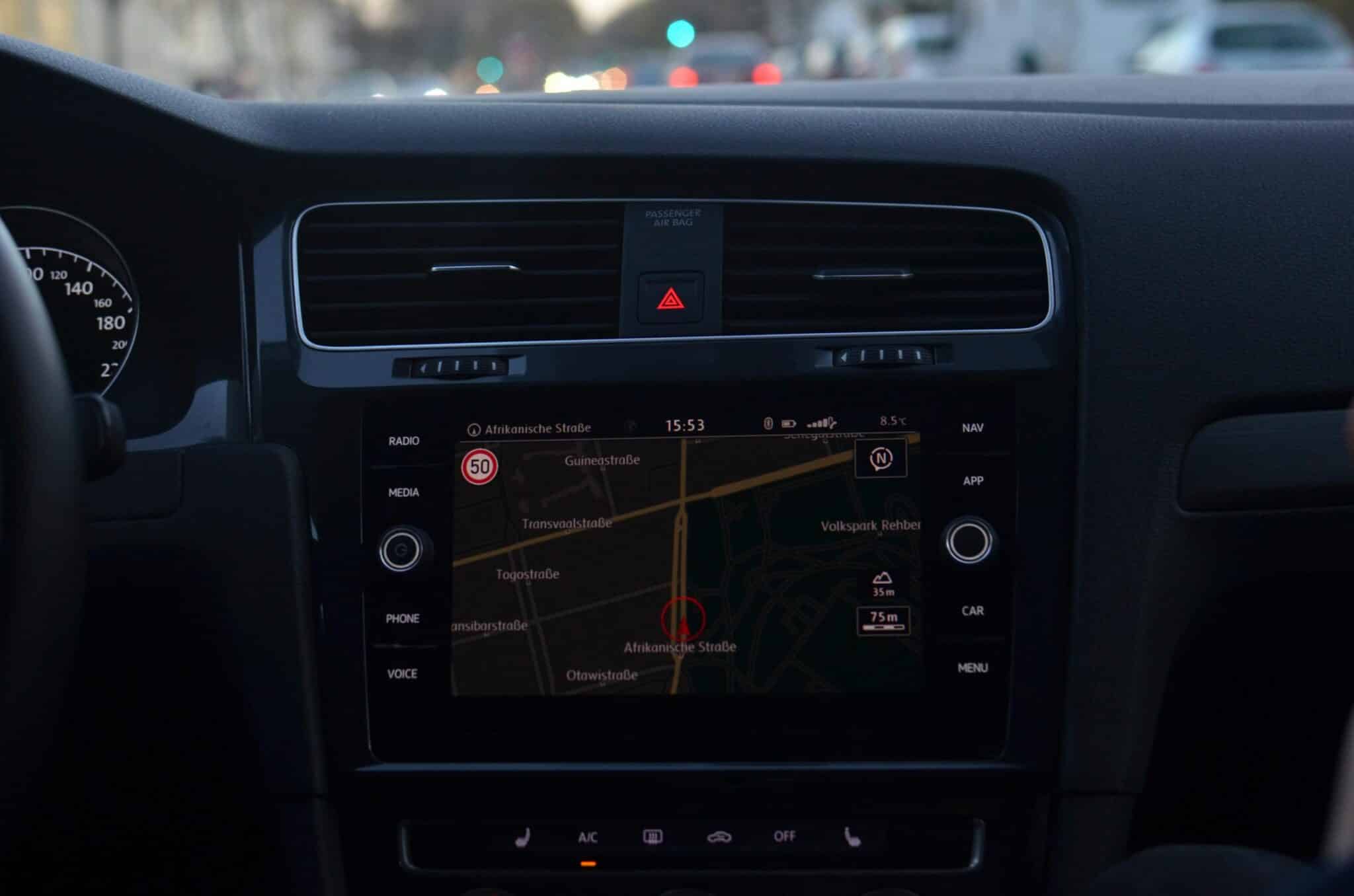
Speed Limit Display
Many regions support speed limit indicators that show the posted speed for your current road segment. This feature helps you maintain legal speeds without constantly watching for speed limit signs.
Some versions also include speed trap warnings reported by other users, though availability varies by location and local regulations regarding such notifications.
Offline Maps for Remote Areas
Google Maps allows downloading specific geographic areas for offline access. This capability ensures navigation continues even without cellular data coverage, essential for rural travel or international trips where data roaming costs are prohibitive.
Downloaded maps include full routing capabilities, business information, and points of interest. The offline experience closely mirrors online functionality, with obvious limitations regarding real-time traffic data.
🌐 Multi-Stop Route Planning
Planning trips with multiple destinations becomes effortless with Google Maps’ multi-stop functionality. This feature optimizes the sequence of visits, saving time and fuel by creating efficient routing paths.
To add stops, enter your final destination first, then tap the three-dot menu and select “Add stop.” You can include up to nine additional waypoints, creating comprehensive route plans for errands, deliveries, or tourist itineraries.
The app allows reordering stops by dragging them into different sequences. While it doesn’t automatically optimize the order, you can manually experiment with arrangements to find the most efficient path.
Each stop displays individual segment times and distances, helping you understand how long you’ll spend at each phase of your journey. This transparency aids in realistic scheduling and time management.
🔍 Exploring Points of Interest Along Your Route
Google Maps integrates extensive business and location data, allowing you to discover restaurants, gas stations, hotels, and attractions near your route. This integration transforms the app from simple navigation into a comprehensive travel companion.
The “Search along route” feature lets you find specific categories without deviating significantly from your path. Enter search terms like “coffee shop” or “pharmacy,” and the app displays relevant options with minimal detour distances.
Each location includes reviews, photos, operating hours, and contact information. This rich detail helps you make informed decisions about where to stop without leaving the navigation interface.
📱 Voice Commands and Hands-Free Operation
Safety remains paramount during navigation. Google Maps supports extensive voice control, allowing you to adjust settings, search destinations, and receive guidance without touching your device.
Activate voice commands by saying “Hey Google” or “OK Google,” followed by your request. You can ask for directions, inquire about arrival times, report traffic incidents, or search for nearby services entirely through speech.
Voice guidance quality has improved dramatically through neural text-to-speech technology. Instructions sound natural and clear, with appropriate emphasis on street names and distances.
🔄 Real-Time Route Adjustments
Google Maps continuously evaluates your route even after navigation begins. When conditions change or faster alternatives emerge, the app notifies you about potential time savings from route changes.
These suggestions appear as notifications showing the time difference between your current route and the proposed alternative. You can accept the new route with a single tap or dismiss the suggestion if you prefer your current path.
The system balances stability with optimization, avoiding excessive route changes that might cause confusion. Only when substantial improvements exist does the app recommend switching paths.
🌟 Sharing Your Location and ETA
Google Maps includes location-sharing features that let friends and family track your progress. This functionality provides peace of mind for loved ones awaiting your arrival and proves useful for coordinating meetups.
When sharing your ETA, recipients receive a live link showing your current position and updated arrival time. They don’t need Google Maps installed to view this information, as it works through standard web browsers.
You control sharing duration, from temporary sharing that expires after your trip to continuous sharing that remains active until you disable it. Privacy controls ensure you maintain complete authority over your location visibility.
🚗 Integration with Vehicle Systems
Modern vehicles increasingly feature Android Auto or Apple CarPlay compatibility, bringing Google Maps to your dashboard display. This integration provides safer, more convenient access to navigation while driving.
The vehicle-optimized interface features larger buttons, simplified menus, and streamlined information display suited for quick glances. Voice control becomes even more important in this environment, minimizing manual interaction.
Your navigation history, saved places, and preferences sync seamlessly between phone and vehicle displays, creating a consistent experience across devices.
💡 Tips for Optimal Navigation Experience
Maximizing Google Maps effectiveness involves understanding lesser-known features and best practices. These strategies enhance accuracy, convenience, and overall satisfaction with the navigation experience.
Enable high-accuracy location mode in your device settings for the most precise positioning. This mode uses GPS, Wi-Fi, mobile networks, and sensors simultaneously, providing the best possible location accuracy.
Regularly update the Google Maps app to access the latest features, improved algorithms, and expanded data coverage. Updates often include performance enhancements that make the app faster and more reliable.
Save frequent destinations like home and work addresses in your profile. This simplification allows one-tap navigation to these locations and enables personalized traffic alerts about your regular commute routes.
Explore the “Commute” tab for predictive information about your usual routes. Google Maps learns your patterns and proactively displays relevant traffic information before you even open the app.
🌍 Global Coverage and Regional Variations
Google Maps operates worldwide, but feature availability and data quality vary by region. Urban areas typically enjoy comprehensive coverage with detailed business information, real-time transit updates, and extensive street view imagery.
Rural and remote regions may have basic mapping and routing without advanced features like traffic data or indoor maps. However, coverage continuously expands as Google collects more information and partners with local authorities.
International travelers benefit from consistent interface and functionality regardless of destination. The app automatically adapts to local languages, measurement systems, and transportation options without requiring manual configuration.
🔐 Privacy Considerations and Location History
Google Maps collects location data to provide personalized recommendations and improve service quality. Understanding privacy settings helps you balance functionality with data preferences.
Location History, when enabled, creates a timeline of your travels viewable in your Google account. This feature powers personalized suggestions but can be paused or deleted entirely if you prefer not to maintain this record.
The app allows navigation in Incognito Mode, which prevents saving search history, location data, or route information to your account. This temporary privacy mode proves useful when you prefer certain trips remain unrecorded.
🚀 The Future of Digital Navigation
Google continuously enhances Maps with emerging technologies. Augmented reality features now overlay directional arrows onto live camera views, making complex pedestrian navigation more intuitive, especially in dense urban environments.
Environmental routing considers fuel efficiency and emissions, suggesting routes that minimize environmental impact. Electric vehicle owners benefit from charging station integration that accounts for battery range and charging times.
Artificial intelligence improvements enable more accurate predictions, better understanding of natural language queries, and personalized recommendations that align with individual preferences and travel patterns.
Google Maps has evolved from a simple digital map into an intelligent navigation companion that anticipates needs, adapts to circumstances, and provides comprehensive travel support. Whether you’re navigating daily commutes or exploring unfamiliar territories, the app delivers reliable guidance that helps you reach destinations efficiently while avoiding unexpected delays. The combination of precise GPS tracking, real-time traffic intelligence, and accurate time estimates creates a navigation experience that has fundamentally changed how we move through the world. By understanding and utilizing the full range of features available, you transform routine travel into informed, stress-free journeys where you remain confidently in control regardless of what surprises the road might present.

Toni Santos is a visionary artisan and conceptual designer who channels the beauty of living organisms into structural expression. At Zureste, Toni explores the intricate elegance of insect anatomy, organic flow, and bioinspired design to create art that feels both natural and otherworldly.
Each creation Toni brings to life reflects a harmonic tension between structure and softness, wildness and control — echoing the complex intelligence found in the natural world. From beetle-like silhouettes to root-shaped contours, his work blurs the lines between biology, sculpture, and modern art.
Guided by fascination for metamorphosis, evolution, and pattern in nature, Toni’s pieces embody transformation. His BioLight Collection and conceptual series like Insect Type and Structure Aesthetics offer viewers more than aesthetic value — they present immersive experiences of living design.
As the creative force behind Zureste, Toni invites us to rethink beauty, architecture, and identity through a new lens — one shaped by wings, bones, spirals, and the microscopic poetry of the organic.
His creations reflect:
-
Design deeply rooted in the geometry of life
-
Inspiration from insects, roots, and the unseen natural order
-
A blend of science, spirituality, and visual storytelling
Whether you’re a lover of strange beauty, an admirer of evolution’s artistry, or a creative mind seeking something different, Toni welcomes you into a world where living forms become meaning, and surreal becomes sublime.