
Anúncios
In a world where natural disasters strike without warning, staying informed about seismic activity can be lifesaving. Earthquake detection apps have revolutionized how we prepare for and respond to tremors.


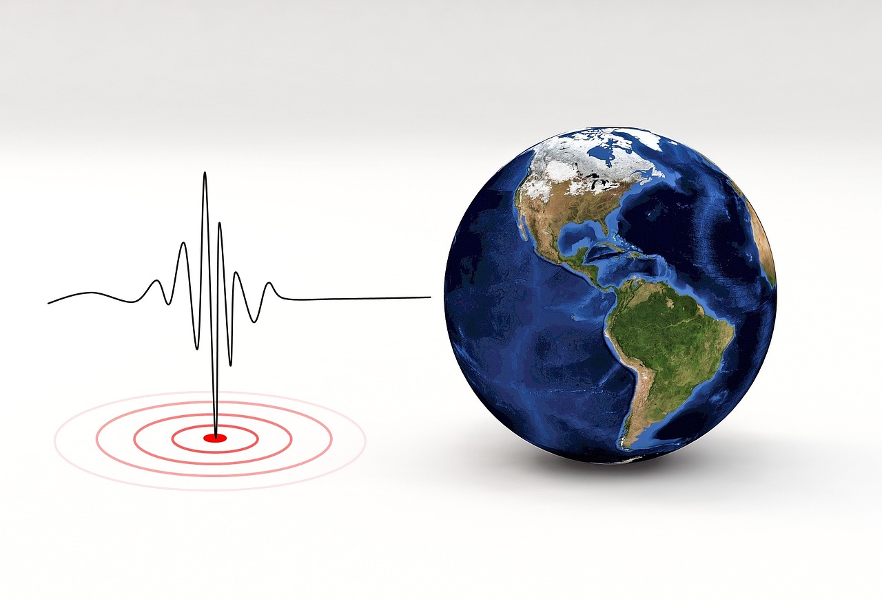
Earthquakes remain one of nature’s most unpredictable phenomena, capable of causing devastating damage within seconds. While we cannot prevent these geological events, modern technology has given us powerful tools to detect, track, and receive instant notifications about seismic activity anywhere in the world.
Anúncios
Mobile applications dedicated to earthquake monitoring have become essential companions for millions of people living in seismically active regions.

These sophisticated apps combine real-time data from geological survey networks, advanced mapping technologies, and push notification systems to keep users informed about tremors both near and far. Whether you’re concerned about local safety, tracking global seismic patterns, or simply curious about Earth’s dynamic nature, earthquake detection apps offer unprecedented access to critical information right at your fingertips.
Anúncios
🌍 Understanding Earthquake Detection Technology
Modern earthquake detection apps rely on extensive networks of seismometers scattered across the globe. These sensitive instruments measure ground motion and transmit data to central databases maintained by organizations like the United States Geological Survey (USGS), the European-Mediterranean Seismological Centre (EMSC), and national geological agencies worldwide.
When seismic activity occurs, these networks detect the tremors within seconds and calculate essential parameters including magnitude, depth, location coordinates, and potential impact radius. This information is then distributed through various channels, including mobile applications that process and present the data in user-friendly formats.
The speed at which this information travels has improved dramatically over the past decade. What once took hours to compile and report now happens in near real-time, often within minutes of an earthquake’s occurrence. This rapid dissemination of information can provide crucial warning time for areas farther from the epicenter, where seismic waves take longer to arrive.
📱 Key Features of Top Earthquake Alert Apps
The most effective earthquake monitoring applications share several core functionalities that make them invaluable for both casual users and those living in high-risk zones. Understanding these features helps you make informed decisions about which app best suits your needs.
Real-Time Push Notifications
The cornerstone feature of any earthquake app is its alert system. Quality applications send instant push notifications when seismic activity is detected, with customizable settings that let you filter alerts based on magnitude thresholds, distance from your location, and specific regions of interest.
Advanced notification systems categorize earthquakes by severity, using different alert tones and urgency levels. A magnitude 7.0 earthquake near a populated area triggers a different response than a minor 3.5 tremor in a remote location. This intelligent filtering prevents alert fatigue while ensuring you never miss critical warnings.
Interactive Seismic Maps
Visual representation transforms raw data into comprehensible information. Top-tier earthquake apps feature interactive maps that display recent tremors with color-coded markers indicating magnitude and age. Users can zoom in on specific regions, view earthquake clusters, and identify fault lines and tectonic plate boundaries.
These maps often include multiple layers showing historical activity, aftershock sequences, and predicted shake intensity zones. The ability to visualize earthquake patterns helps users understand their local seismic risk and appreciate the global scope of tectonic activity.
Comprehensive Earthquake Lists and Filters
Beyond maps, detailed lists provide searchable records of recent seismic events. Users can sort earthquakes by magnitude, time, distance, or location, and apply filters to focus on specific regions or magnitude ranges. This functionality proves particularly useful for researchers, journalists, and anyone tracking ongoing seismic sequences.
Historical data access allows users to review earthquakes from days, weeks, or even months past, helping identify patterns and understand regional seismic behavior over time.
🔔 Customizing Your Alert Preferences
One size doesn’t fit all when it comes to earthquake notifications. The best apps recognize this by offering extensive customization options that balance staying informed with avoiding unnecessary interruptions.
Users can typically set minimum magnitude thresholds, ensuring notifications only arrive for earthquakes above a certain strength. For instance, someone in California might set alerts for magnitude 4.0 and above locally, while monitoring magnitude 6.0+ events globally.
Geographic filtering lets you define specific regions of interest, whether it’s your current location, your hometown, places where family lives, or regions you’re monitoring for professional or personal reasons. Radius-based alerts notify you of tremors within a specified distance from chosen locations.
Time-based controls prevent notifications during sleeping hours or important meetings, while allowing critical alerts to override these settings based on severity. This intelligent notification management ensures you stay informed without experiencing alert burnout.
🗺️ Navigating Earthquake Maps Effectively
Understanding how to interpret earthquake maps maximizes the value you extract from these applications. Most apps use standardized color schemes where warm colors (red, orange) indicate recent or strong earthquakes, while cooler colors (blue, green) represent older or weaker events.
Marker size often corresponds to magnitude—larger circles indicate more powerful earthquakes. Clicking or tapping individual markers reveals detailed information including precise location coordinates, depth, magnitude, time of occurrence, and distance from your current position.
Many applications overlay additional geographic data such as population density, major cities, fault lines, and tectonic plate boundaries. This contextual information helps assess potential impact and understand why certain regions experience frequent seismic activity.
Some advanced features include animation modes that replay earthquake sequences over time, revealing patterns in aftershock progression or the migration of seismic activity along fault systems. These visualizations transform abstract data into compelling narratives about our dynamic planet.
📊 Understanding Earthquake Magnitude and Depth
Interpreting earthquake data requires basic understanding of magnitude scales and depth measurements. Most modern apps report magnitude using the Moment Magnitude Scale (Mw), which has largely replaced the older Richter scale for measuring larger earthquakes.
The magnitude scale is logarithmic, meaning each whole number increase represents approximately 32 times more energy release. A magnitude 6.0 earthquake releases roughly 1,000 times more energy than a magnitude 4.0 event. This exponential relationship explains why magnitude differences of even one point represent dramatically different destructive potential.
Depth plays an equally crucial role in determining an earthquake’s impact. Shallow earthquakes (0-70 km deep) generally cause more surface damage than deeper events of similar magnitude, as seismic waves have less distance to attenuate before reaching the surface. Apps typically classify earthquakes as shallow, intermediate (70-300 km), or deep (300+ km).
🌐 Global Coverage and Data Sources
Reliable earthquake apps aggregate data from multiple authoritative sources to ensure comprehensive global coverage. The primary sources include:
- USGS (United States Geological Survey): Provides worldwide earthquake monitoring with particularly detailed coverage of the Americas and Pacific regions
- EMSC (European-Mediterranean Seismological Centre): Specializes in European, Mediterranean, and Middle Eastern seismic activity
- GFZ (German Research Centre for Geosciences): Offers rapid global earthquake information and specialized research data
- National seismological networks: Country-specific agencies like Japan’s JMA, New Zealand’s GeoNet, and others provide localized detail
By combining multiple data streams, top applications cross-reference information to improve accuracy and reduce false positives. They also display source attribution, allowing users to verify information through official channels when needed.
🏠 Safety Features and Emergency Preparedness
Beyond monitoring, many earthquake apps incorporate safety resources designed to help users prepare for and respond to seismic events. These features transform passive information tools into active safety companions.
Emergency checklists guide users through preparedness steps, including assembling disaster kits, identifying safe spots in homes and workplaces, and creating family communication plans. Some apps offer location-based safety tips that account for regional building codes and typical construction methods.
Post-earthquake guidance helps users assess damage, decide whether to evacuate, and report their safety status to emergency services or concerned contacts. Integration with social media and messaging platforms enables quick communication during disasters when cellular networks may be overwhelmed.
Educational content explains earthquake science in accessible terms, helping users understand what causes tremors, why certain regions face higher risk, and how building codes and engineering innovations reduce damage. This knowledge empowers informed decision-making about where to live, work, and travel.
⚡ Early Warning Systems and Their Limitations
Some advanced earthquake apps connect to early warning systems that detect the initial, faster-moving seismic waves (P-waves) and send alerts before the more destructive secondary waves (S-waves) arrive. This can provide precious seconds to minutes of warning time.
Countries like Japan, Mexico, and the United States have implemented or are developing such systems. Apps that integrate with these networks can automatically trigger protective actions on connected devices, such as stopping elevators at the nearest floor, shutting off gas valves, or alerting surgeons mid-procedure.
However, it’s crucial to understand the limitations. Warning time depends on distance from the epicenter—those closest to the source may receive no advance notice, while those farther away gain more time. Additionally, the system cannot predict earthquakes before they begin; it only detects them early in their progression.
🔍 Tracking Aftershock Sequences
Following a major earthquake, aftershocks can continue for days, weeks, or even months. Earthquake apps excel at tracking these sequences, helping users understand ongoing risks and prepare for continued seismic activity.
Aftershocks typically decrease in frequency and magnitude over time, following predictable statistical patterns. Apps that display aftershock progression help users visualize this decay and identify anomalies that might indicate continued danger or even foreshocks to a larger event.
Filtering capabilities allow users to isolate aftershock sequences from unrelated seismic activity, creating clearer pictures of how fault systems relieve stress after major ruptures. This information proves valuable for both personal safety planning and understanding earthquake mechanics.
📈 Historical Data and Pattern Analysis
Access to historical earthquake data opens fascinating windows into long-term seismic patterns. Many apps provide archives stretching back years or decades, enabling users to explore how seismic activity has evolved in specific regions.
These historical views reveal earthquake clusters, identify periods of heightened or reduced activity, and help contextualize current events within broader temporal patterns. While earthquake prediction remains scientifically elusive, understanding historical patterns contributes to informed risk assessment.
Researchers and enthusiasts can export data for further analysis, creating custom visualizations or integrating earthquake information with other datasets. This accessibility democratizes seismological information, fostering broader public understanding of Earth sciences.
🌟 User Experience and Interface Design
The best earthquake apps balance feature richness with intuitive design. Clean interfaces present complex data without overwhelming users, employing clear visual hierarchies that guide attention to the most important information.
Dark mode options reduce eye strain during nighttime checking, while high-contrast alert screens ensure critical notifications remain visible under any conditions. Accessibility features like screen reader compatibility and adjustable text sizes ensure everyone can benefit from earthquake monitoring regardless of visual abilities.
Performance optimization ensures apps launch quickly and update smoothly even during high-traffic periods following major earthquakes when millions of users simultaneously check for information. Offline functionality maintains access to recently cached data even when internet connections fail.
🔐 Privacy and Data Management
Responsible earthquake apps respect user privacy while providing location-based services. Transparent privacy policies explain what data is collected, how it’s used, and whether it’s shared with third parties.
Location services enable personalized alerts and distance calculations, but reputable apps allow users to manually set locations rather than continuously tracking GPS coordinates. This approach balances functionality with privacy, giving users control over their data exposure.
Battery optimization ensures background monitoring doesn’t drain device power excessively. Efficient apps check for updates at reasonable intervals, send notifications only when necessary, and use power-saving location methods when precise GPS isn’t required.
💡 Choosing the Right Earthquake App for Your Needs
Selecting an earthquake app depends on your specific requirements and risk profile. Those living in seismically active regions need robust alert systems with fine-tuned customization options, while users in stable areas might prioritize global monitoring and educational content.
Consider whether you need multi-platform support if you use various devices, and check if the app offers web interfaces for desktop monitoring. Free apps often provide excellent basic functionality, while premium versions may include advanced features like extended historical data, ad-free experiences, or professional-grade analytical tools.
Read user reviews focusing on alert reliability, false positive rates, and developer responsiveness to issues. The best apps maintain active development, regularly updating data sources and adapting to new seismological network capabilities.
🌏 The Future of Earthquake Monitoring Technology
Earthquake detection technology continues evolving rapidly. Emerging innovations include crowd-sourced seismic detection using smartphone accelerometers, machine learning algorithms that improve magnitude estimation and location accuracy, and integration with smart home systems for automated protective responses.
Advances in satellite technology enable detection of ground deformation that may precede major earthquakes, while improved sensor networks in developing regions expand global coverage. These developments promise to make earthquake apps even more valuable tools for safety and scientific understanding.
As climate change potentially influences seismic activity through mechanisms like ice sheet melting and changing water distribution, ongoing monitoring becomes increasingly important. Earthquake apps will continue serving as crucial bridges between complex geophysical data and public awareness, helping communities worldwide prepare for and respond to seismic events.
By installing a reliable earthquake detection app today, you’re taking a proactive step toward personal safety and joining millions of globally connected users who monitor our dynamic planet together. These powerful tools transform smartphones into personal seismological stations, delivering critical information that once required specialized equipment and expertise. Whether you’re motivated by safety concerns, scientific curiosity, or both, earthquake apps represent essential modern resources for understanding and responding to one of nature’s most powerful forces.

Toni Santos is a visionary artisan and conceptual designer who channels the beauty of living organisms into structural expression. At Zureste, Toni explores the intricate elegance of insect anatomy, organic flow, and bioinspired design to create art that feels both natural and otherworldly.
Each creation Toni brings to life reflects a harmonic tension between structure and softness, wildness and control — echoing the complex intelligence found in the natural world. From beetle-like silhouettes to root-shaped contours, his work blurs the lines between biology, sculpture, and modern art.
Guided by fascination for metamorphosis, evolution, and pattern in nature, Toni’s pieces embody transformation. His BioLight Collection and conceptual series like Insect Type and Structure Aesthetics offer viewers more than aesthetic value — they present immersive experiences of living design.
As the creative force behind Zureste, Toni invites us to rethink beauty, architecture, and identity through a new lens — one shaped by wings, bones, spirals, and the microscopic poetry of the organic.
His creations reflect:
-
Design deeply rooted in the geometry of life
-
Inspiration from insects, roots, and the unseen natural order
-
A blend of science, spirituality, and visual storytelling
Whether you’re a lover of strange beauty, an admirer of evolution’s artistry, or a creative mind seeking something different, Toni welcomes you into a world where living forms become meaning, and surreal becomes sublime.